
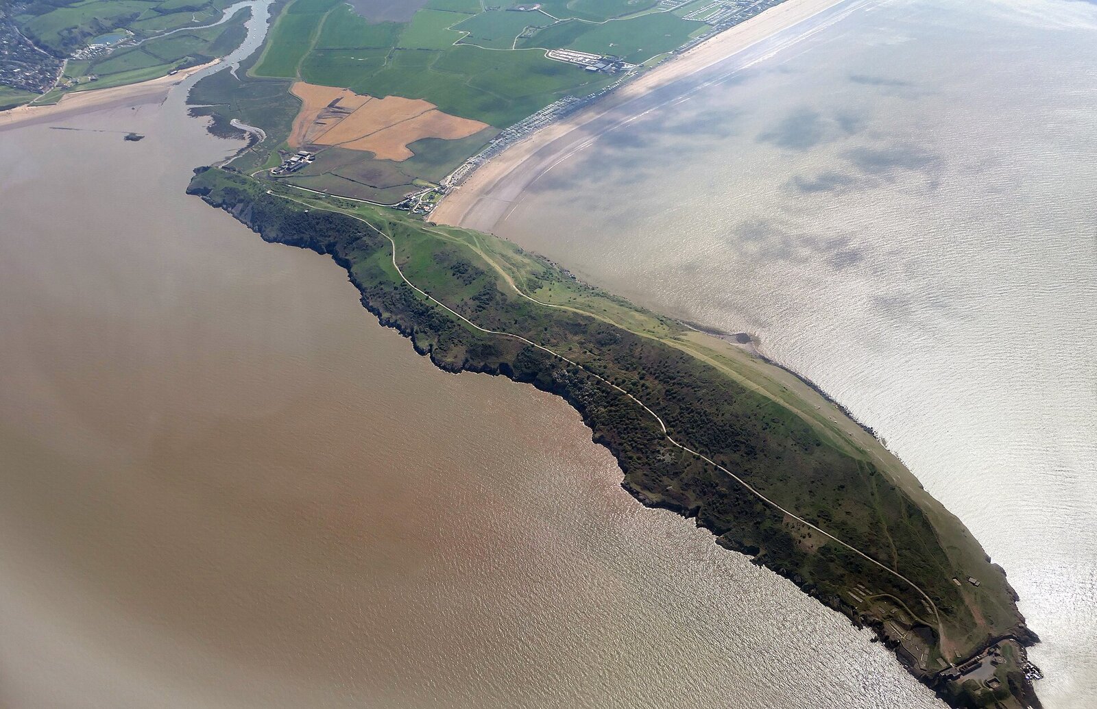
The Brean Down walk is the one we recommend when guests want big views without a big hike. A limestone headland jutting a mile and a half into the Bristol Channel, with a Victorian fort at the tip, the sea on both sides and the whole Somerset coast laid out behind you. It is twenty-five minutes from our cottages in Kewstoke and one of the best short walks in the county. Here is how to do it properly.
In this guide
Brean Down walk at a glance
- Distance: about three miles there and back along the ridge.
- Time: one and a half to two hours at a gentle pace with stops.
- Difficulty: moderate. One steep climb at the start, then easy walking.
- Start: National Trust car park at the end of the road at Brean, TA8 2RS.
- Dogs: welcome on leads, because of the goats and the cliffs.
Getting to the start
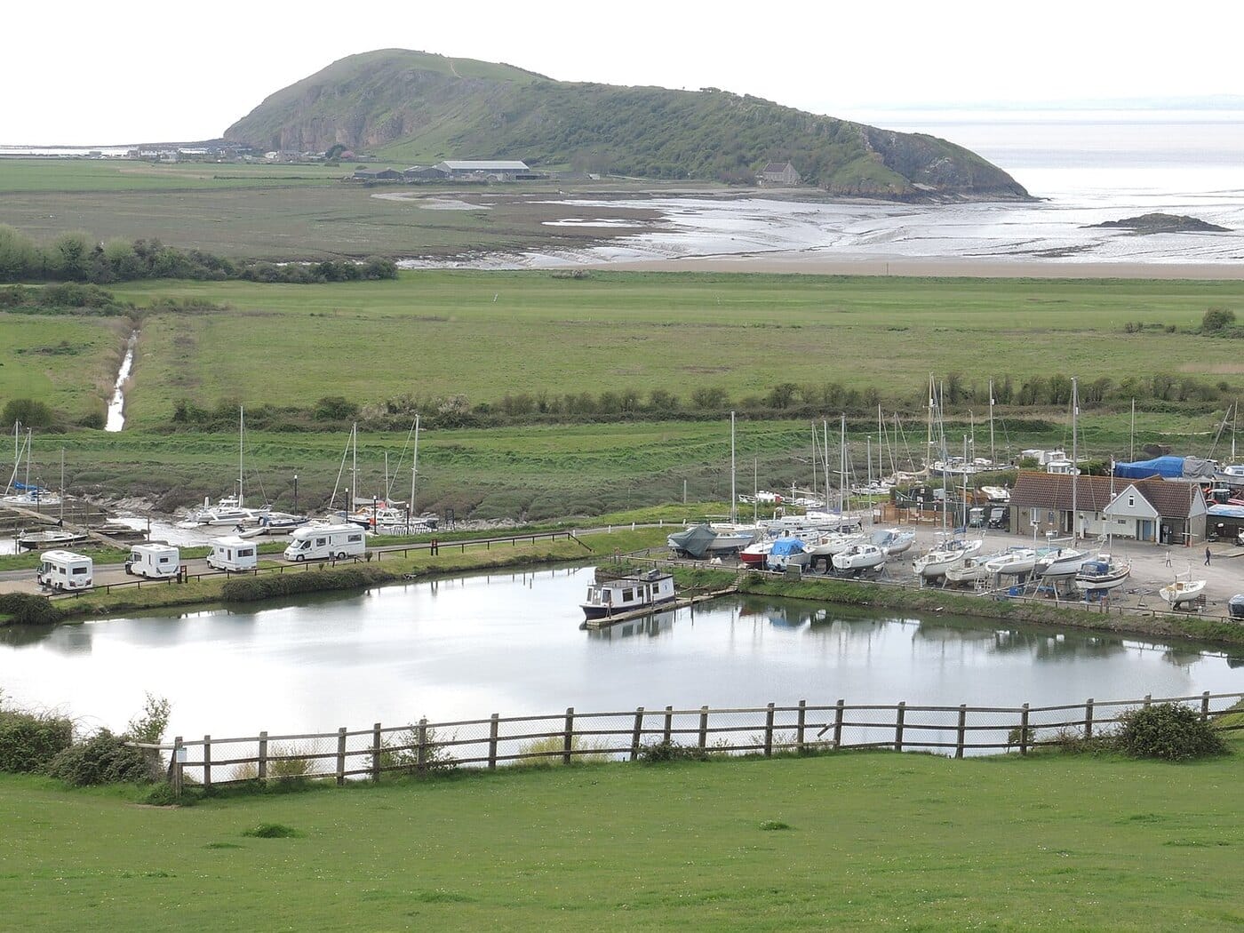
From Weston, Brean Down is across the River Axe, so although you can see it from Uphill Beach you cannot walk to it. Drive south on the A370 and follow signs for Brean, then keep going along the coast road until it ends at the National Trust car park beneath the headland. The National Trust page has parking details and any seasonal closures.
The climb
There are two ways up. The steps beside the café are the direct route: a steep flight cut into the hillside that gets the heart going but is over in ten minutes. The gentler option is the path that starts a little further along and zigzags up the southern slope. Either way you arrive on the ridge with the Bristol Channel suddenly on both sides, and this is where the Brean Down walk really begins.
Along the ridge
The path runs west along the spine of the headland for about a mile. To the north is Weston Bay, with the Grand Pier, Uphill church on its hill and, beyond it, Sand Point and our own stretch of coast. To the south the beach runs unbroken to Burnham-on-Sea and the Quantocks rise in the distance. Wales is straight ahead across the water.
Look out for the feral goats that graze the slopes, the remains of an Iron Age hillfort and a Romano-British temple, and in spring the wildflowers that make this one of the best spots on the coast for butterflies.
The fort at the end
Brean Down Fort was built in the 1860s as one of the Palmerston forts guarding the Bristol Channel, and it was rearmed in the Second World War. You can wander around the gun emplacements and the old barracks, and the drop to the sea from the tip of the headland is dramatic. Keep children and dogs close here.
The way back
Most people return along the ridge the way they came, which gives you the Weston views on the way out and the Burnham views on the way back. Fitter walkers can drop down to the beach at low tide and walk back along the sand beneath the cliffs, then climb the steps at the end. Check the tide first, because the sea comes in fast across the flats.
Tides, weather and safety
The headland is exposed. On a windy day it is bracing at the very least, and in a gale it is better left alone. The cliffs are unfenced in places, so stay on the path. If you plan to use the beach for any part of the walk, check the tide times before you set off, as the Bristol Channel has a huge range and the sand can be covered quickly.
Extending the day
Brean beach below the headland is enormous, flat and mostly dog friendly outside the marked sections, so many families combine the walk with a run on the sand. Brean Leisure Park, a short drive back along the coast road, has rides for children who have earned a reward. Our dog beaches guide and days out guide have more for the area.

Brean Down history: from Iron Age to Second World War
People have used Brean Down for thousands of years. There is a Bronze Age burial mound and an Iron Age hillfort on the ridge, and the remains of a small Romano-British temple built in the fourth century. The Victorian fort at the tip was completed in 1871 as one of a chain of forts guarding the approach to Bristol, though its guns never fired in anger. In 1900 a gunner blew up the magazine, and the fort was abandoned until the Second World War brought new guns, searchlights and experimental weapons testing to the headland.
The National Trust has looked after Brean Down since 1954, and the fort buildings, gun emplacements and searchlight posts are open to wander around. Information boards explain what you are looking at.
Wildlife on Brean Down
The headland is a nature reserve as well as a landmark. The thin limestone soils grow rare plants, including white rock-rose and Somerset hair-grass, and the south-facing slopes are one of the best places in the region for butterflies in summer. The feral goats were introduced to keep the scrub down and are now part of the scenery. Peregrine falcons nest on the cliffs, and the mudflats below are important for wading birds in winter.
Brean Down for families
Children who can manage the steps at the start will love the rest: a ridge to run along, a fort to explore, goats to spot and the sea on both sides. Keep hold of small hands near the fort, where the drops are steep. The beach below is a huge natural playground at low tide, and Brean Leisure Park along the coast road is the reward for tired legs. Allow half a day for the walk and the beach, a full day if you add the rides.
Brean Down for dog walkers
Dogs are welcome on the headland on leads, because of the goats, the grazing and the cliffs. The beach below is dog friendly outside the marked summer sections, and the combination of headland and sand makes Brean Down one of the best dog days out on this coast. Bring water: there is none on the ridge, and the climb is thirsty work on a warm day.
Where to eat near Brean Down
There is a café at the foot of the steps by the car park, open most of the year, and beach cafés and pubs along the coast road through Brean and Berrow. Burnham-on-Sea, ten minutes south, has a proper seafront with fish and chips and a short pier. If you would rather picnic, the ridge has plenty of grassy spots with a view, and the fort at the end has sheltered corners out of the wind.
Brean Down at a glance: tips from us
- Check the weather. The headland is exposed and no fun in a gale.
- Take the steps up and the zigzag path down if knees are a concern.
- Look back often. The views of Weston and Sand Point are behind you on the way out.
- Give the goats space; they are wild and have horns.
- Combine with Uphill Beach on the other side of the river for two headland views in one day.
- The National Trust car park is pay and display, free for members.
Other headland walks near the farm
If you enjoy the Brean Down walk, Sand Point at the end of our own beach is its northern twin: a smaller National Trust headland with the same big views and a five-minute walk from the cottages. Our best walks near Weston-super-Mare guide covers both, along with the Mendip Hills inland.
Brean Down: quick answers
How long does the Brean Down walk take?
Allow ninety minutes to two hours for the walk to the fort and back with stops, plus time on the beach if the tide is out.
Is it suitable for pushchairs?
Not the steps, and the ridge path is rough in places. Baby carriers work well; wheeled buggies do not.
Is there a café?
Yes, at the foot of the headland by the car park, plus beach cafés along the coast road.
Can you walk to Brean Down from Weston?
No. The River Axe is in the way and there is no crossing at the mouth. It is twenty-five minutes by road from Weston and Kewstoke.
Stay nearby
Our dog-friendly cottages in Kewstoke are twenty-five minutes from Brean and a few minutes from Sand Bay, so you can do a headland a day. See the cottages, or check the Visit Weston-super-Mare site for the wider coast.